Peak snowmelt in Washington?
It's already gotten big here in Washington. The Wenatchee has been running at 20,000 cfs plus for the better part of a week, and the upper drainage creeks are really going off.
I was down with the flu over the weekend, but managed to bum a ride for an afternoon of roadside scouting along Hwy 2.
We stopped by Alpine Falls and the Park Section of the Top Tye, Eagle Falls on the SF Skykomish, the cruxes of Tumwater, and a brief jaunt up Icicle Creek.
The pictures really only capture the generalities of the day. For a more specific feel of the scale of these flows check the video:
Video: High water in Washington [34MB]
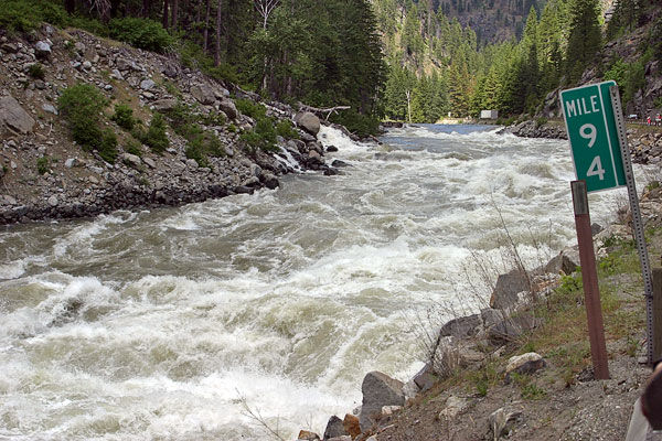

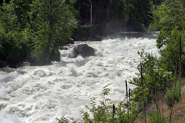
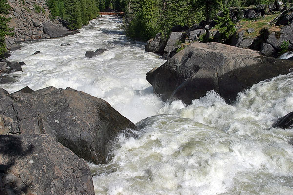
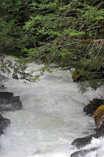
The Wall, Tumwater Canyon @ 20,000 cfs
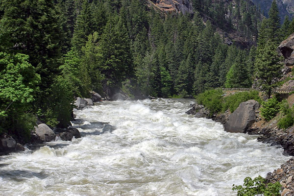
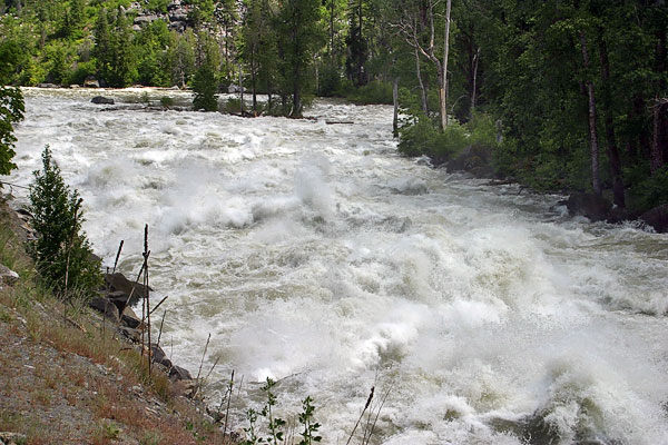
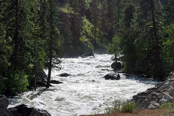
Chaos Cascade, Tumwater
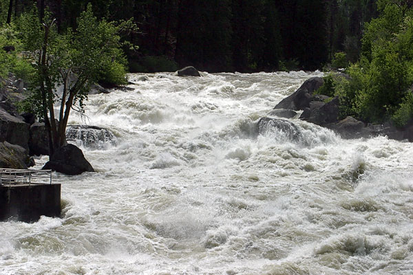
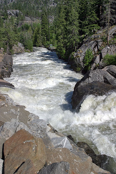
P.O.W., Tumwater
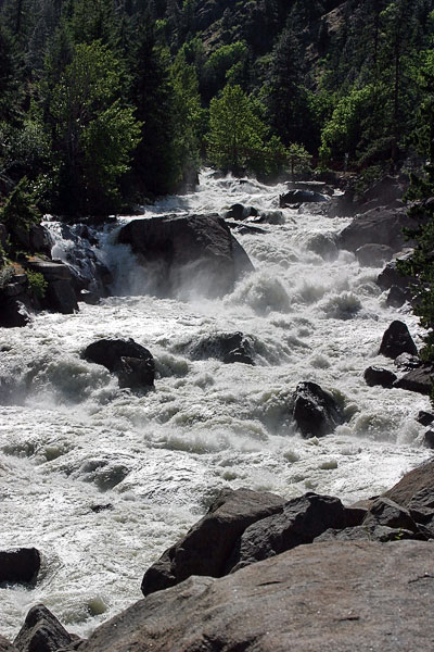
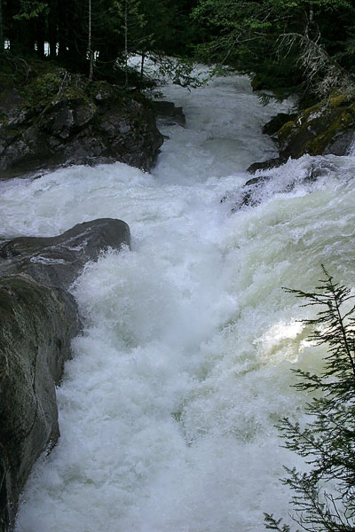
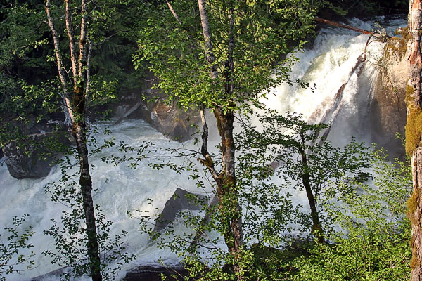
Exit, Tumwater

Below Exit
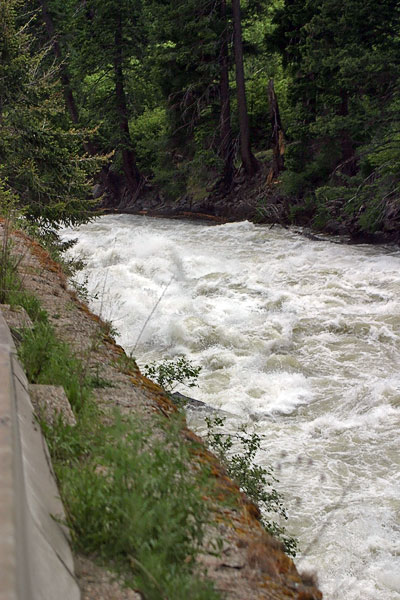
Below the hatchery, Icicle Creek, 4,500 cfs
I think this is The Plunge ... it just looks like The Hole
Crack in the Earth, Top Tye
There was actually water running down the old channel at this flow. the "crack" is visible at the top of this photo.
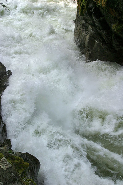
The hydraulic off the left wall at Monkey Cage. Couldn't get any wider.
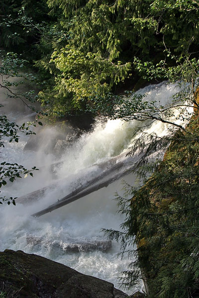
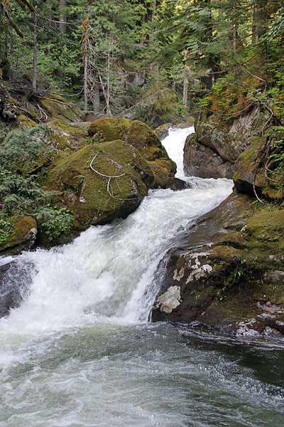
Box Drop and Log Choke Falls, Top Tye
There ya go. Alpine Falls looked incredible, but I ran out of video for it and Monkey Cage. Be safe out there -- there's a whole new forest in our riverbeds.
SYOTR!
I was down with the flu over the weekend, but managed to bum a ride for an afternoon of roadside scouting along Hwy 2.
We stopped by Alpine Falls and the Park Section of the Top Tye, Eagle Falls on the SF Skykomish, the cruxes of Tumwater, and a brief jaunt up Icicle Creek.
The pictures really only capture the generalities of the day. For a more specific feel of the scale of these flows check the video:
Video: High water in Washington [34MB]
The Wall, Tumwater Canyon @ 20,000 cfs
Chaos Cascade, Tumwater
P.O.W., Tumwater
Exit, Tumwater
Below Exit
Below the hatchery, Icicle Creek, 4,500 cfs
I think this is The Plunge ... it just looks like The Hole
Crack in the Earth, Top Tye
There was actually water running down the old channel at this flow. the "crack" is visible at the top of this photo.
The hydraulic off the left wall at Monkey Cage. Couldn't get any wider.
Box Drop and Log Choke Falls, Top Tye
There ya go. Alpine Falls looked incredible, but I ran out of video for it and Monkey Cage. Be safe out there -- there's a whole new forest in our riverbeds.
SYOTR!
posted by slickhorn at 8:37 PM
![]()
![]()
<< Home